Land management and conservation organisations are increasingly adopting cutting-edge technologies to transform landscapes and monitor land condition.
Queensland’s NRM organisations are at the forefront of this work, using technology such as drones, LiDAR, satellite imagery, acoustic monitoring, camera traps and DNA sampling to collect data about species and ecosystems, to map habitats and vegetation cover, to create predictive models and plan and prioritise restoration efforts.
We’ve compiled a selection of current projects using technology to engage graziers, increase vegetation cover, control pests, compare monitoring methods, and monitor significant ecosystems.
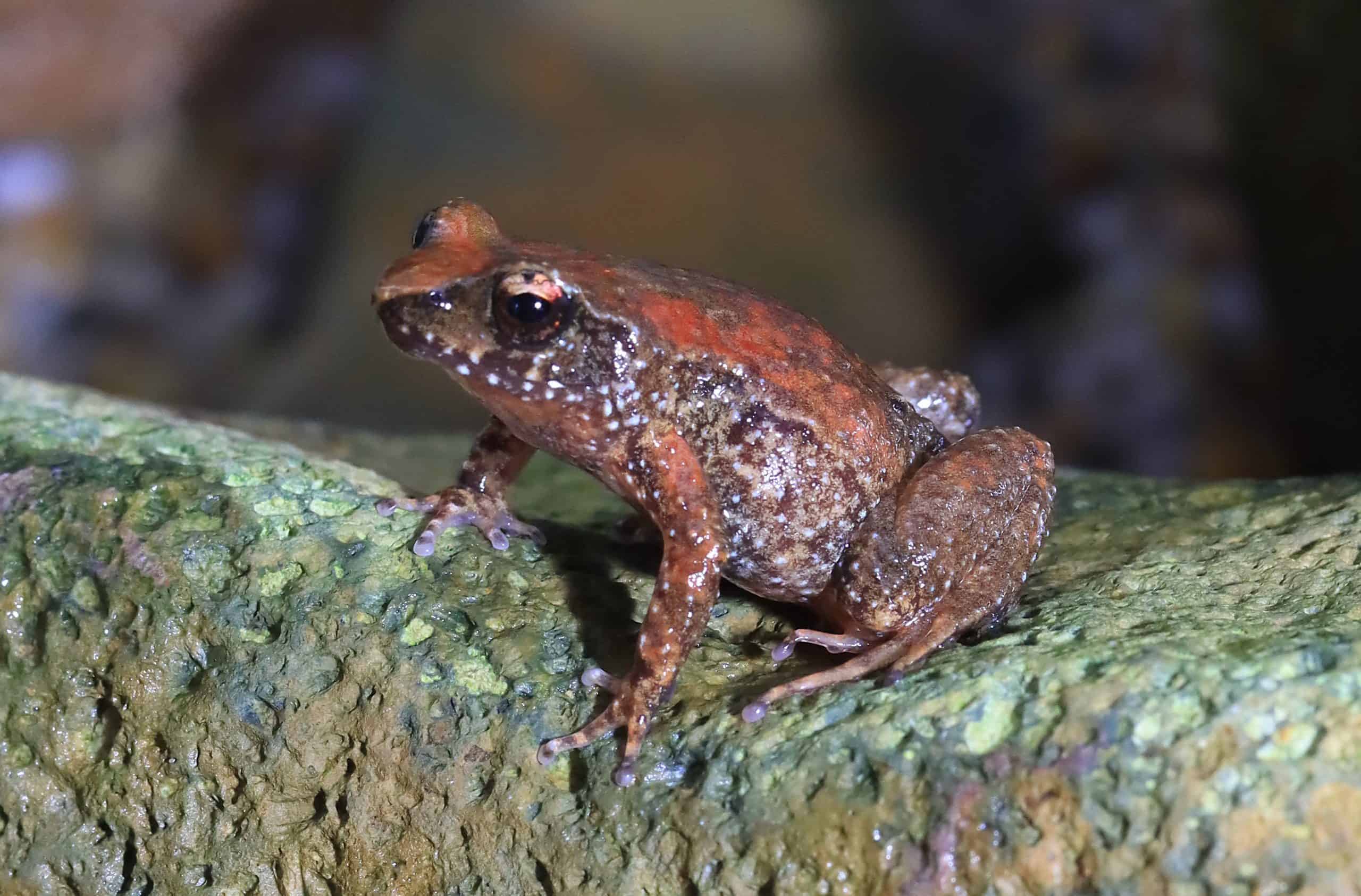
Tpleione Bennie. Photo: R Laredo
Tiny tinkerfrogs benefit from technology
The tiny Kroombit tinkerfrog (Taudactylus pleione), believed to be a post-Gondwanan relic, is critically endangered and found only at Kroombit Tops National Park, central Queensland.
Threatened by feral pigs and a frog-specific fungal disease (amphibian chytridiomycosis), the current population is believed to be as low as a few hundred mature individuals and is in decline.
Much effort has been invested over the last decade to save the Kroombit tinkerfrog from extinction and regional NRM organisation, Fitzroy Basin Association, with its partners, is building on this legacy.
As well as aerial control of feral pigs and supporting land managers to coordinate their pest control efforts, FBA and partners are working together to monitor the species ahead of releasing 100 captive-bred frogs.
More than 20 automated acoustic recorders have been set up to detect populations and eDNA monitoring is identifying potential release sites and verifying baseline population information.
Both eDNA monitoring and call-recognition will continue after the captive-bred frogs have been released.
The project is funded by the Australian Government in partnership with Fitzroy Basin Association, Queensland Parks and Wildlife Service and Currumbin Wildlife Sanctuary.
View Currumbin Wildlife Sanctuary’s video about the frog or: view FBA’s factsheet for more information about the species and this project.
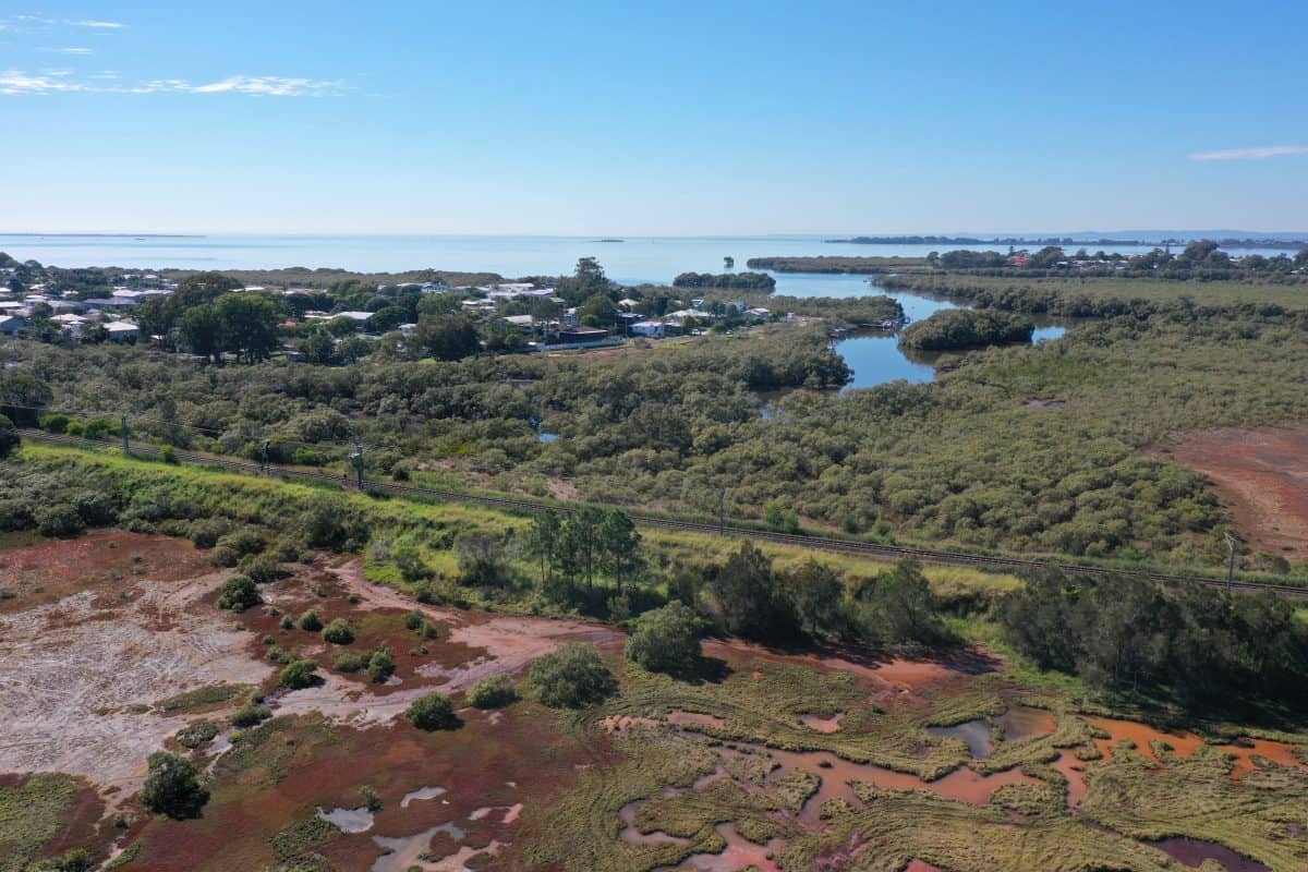
Ransome Road Reserve, Lota
Drones identifying threats to ecosystems in Southeast Queensland
In the Southeast corner, Regional NRM organisation Healthy Land & Water is using drones to identify threats to an at risk endangered regional ecosystem in Lota.
Restoration works including revegetation and weed control are being undertaken to protect saltmarsh and woodland at the reserve. As well as establishing 300 plants the project will also control asparagus vine, lantana and pepper tree under control. As well as being impacted by weeds, the site is also at threat from illegal entry by 4WDs and the project team is hoping to put an end to this with the support of the local council and the community.
Healthy Land and Water Senior Scientist Engineer Samille Loch-Wilkinson has been using drones to capture imagery at the site.
“Using the drones for this project has given us a fantastic birds eye view of the site, allowing us to easily identify threats to the ecosystem,” Samille said.
“We have been able to identify where 4WDs have been illegally entering the reserve and causing significant damage to the area.”
Brisbane Catchment’s Network President Alex Vanek is glad the spotlight is on this special, yet often overlooked reserve.
“The work that we’re doing in partnership with Healthy Land and Water will see the Reserve protected and restored for the local community who enjoy this special area.”
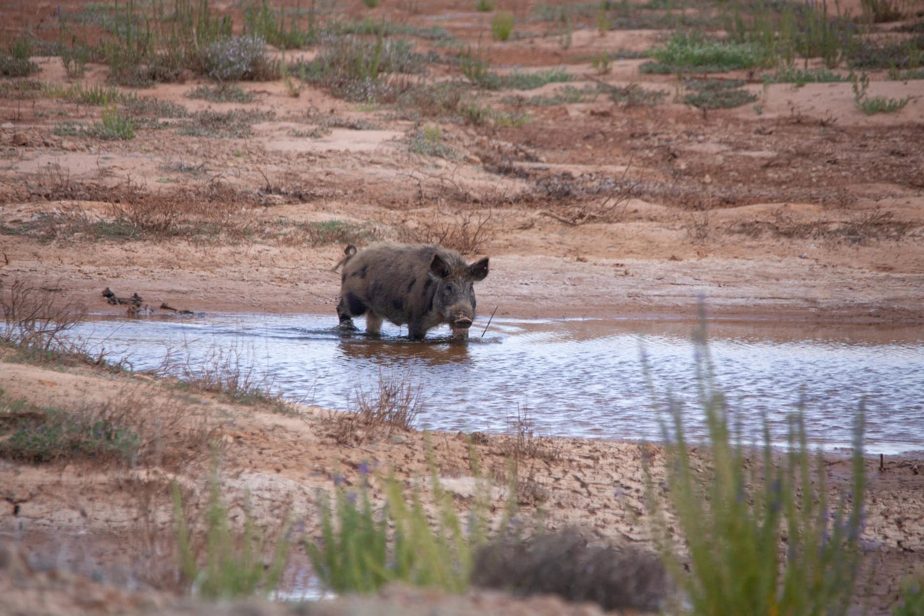
Thermal monitoring technology keeps tabs on Western Downs’ pigs
On the other side of the Great Dividing Range, land managers are struggling to control feral pigs, where monitoring is integral to pest control programs.
Without monitoring population numbers, it’s impossible to know whether pig management strategies are working.
Regional NRM organisation Southern Queensland Landscapes is working in partnership with Western Downs Regional Council and Biosecurity Queensland to help land managers monitor pig populations using new thermal monitoring technology.
The team is comparing the new monitoring methods against traditional methods such as camera monitoring and aerial surveys.
Darren Marshall is Southern Queensland’s Landscapes Lead for Vertebrate Pest and Wildlife Management. He says it’s the first time a comparison has been made between three monitoring methods in one geographical area.
“We can compare and contrast the benefits of each method and see which is most effective in the landscape,” Darren said.
The monitoring method uses an ultra high definition video camera fitted with a thermal imager to detect and record the presence of the pests in real time. The thermal imaging technology detects heat so it allows uers to see pigs when they might be hiding or in areas of thick vegetation.
_ _ _
There are 12 regional NRM organisations in Queensland, each of them delivering projects that are transforming landscapes and engaging land managers. To find your local organisation, visit our interactive map here.