Cape York Wildfire Resilience
Regional NRM organisation: Cape York NRM
Location: Cape York Peninsula, Far North Queensland. Priority fire management areas across southern, central and northern Cape York
Image: Early dry season burn at Balurga Station
Primary themes
Land & Soil
Key partners
- Indigenous Land & Sea Ranger Groups
- Aboriginal Corporations and Land Trusts
- Graziers and pastoral landholders
- Private conservation landholders
- Rural Fire Service Queensland
- Queensland Emergency Services
Overview
Cape York Peninsula is Queensland’s most fire-prone landscape, with vast areas burned each year. In the absence of proactive fire management, large and intense late dry season wildfires can devastate more than half of the region’s remnant vegetation in a single year.
The Cape York Wildfire Resilience project will deliver large-scale, coordinated early dry season burning and fire planning across priority landscapes to reduce the frequency and intensity of destructive wildfires. The project sees Traditional Owners, graziers and land managers collaborate to support property-level fire management planning, regional coordination and on-ground implementation of controlled burns and firebreak preparation.
By restoring more appropriate fire regimes, the project will protect high-value native vegetation, reduce long-term land degradation and strengthen ecosystem resilience. It will also improve disaster preparedness for remote communities and pastoral enterprises by shifting from reactive wildfire response to proactive landscape-scale fire management.
Through coordinated regional delivery and targeted on-ground action, the project will strengthen the resilience of Cape York’s landscapes, protect biodiversity threatened by adverse fire regimes and support long-term land stewardship across one of Queensland’s most ecologically significant regions.
Secondary themes
Disaster resilience and recovery
reducing the scale and intensity of late dry season wildfires that threaten life, property, infrastructure and ecological systems across Cape York.
Climate resilience and adaptation
Responding to increasing wildfire frequency and intensity linked to prolonged dry seasons and climate variability.
Biodiversity conservation
Protecting high-value remnant vegetation and threatened species habitat from repeated high-intensity wildfire impacts.
Indigenous engagement and leadership
Working in a region where over 60 percent of land is Aboriginal Freehold, supporting Traditional Owner fire planning and culturally informed fire management.
Sustainable agriculture
Supporting graziers to manage fire in ways that protect long-term land condition, reduce woody thickening and improve vegetation recovery.
Jobs and regional capacity
Project officers and contractors delivering on-ground fire management and building long-term regional capability.
Fire management
Coordinated early dry season burning and fire planning to restore appropriate fire regimes and reduce the risk of destructive late dry season wildfires.
Landholder engagement
Working directly with graziers and land managers to develop and implement property-level fire management plans.
Capacity building and skills development
Building skills and knowledge among landholders, Indigenous rangers and partners to support long-term landscape stewardship.
Technology and innovation
use of fire scar mapping, monitoring tools and emerging technologies to guide fire planning and assess outcomes.
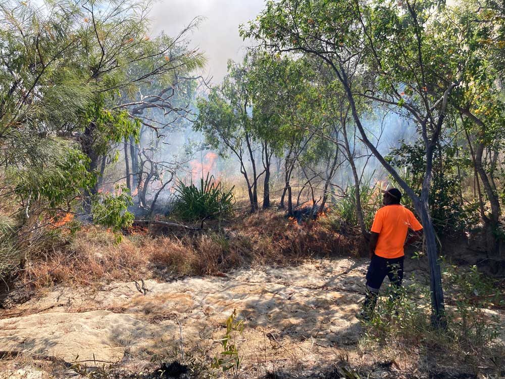
Early dry season burn in Cape Melville National Park (CYPAL)
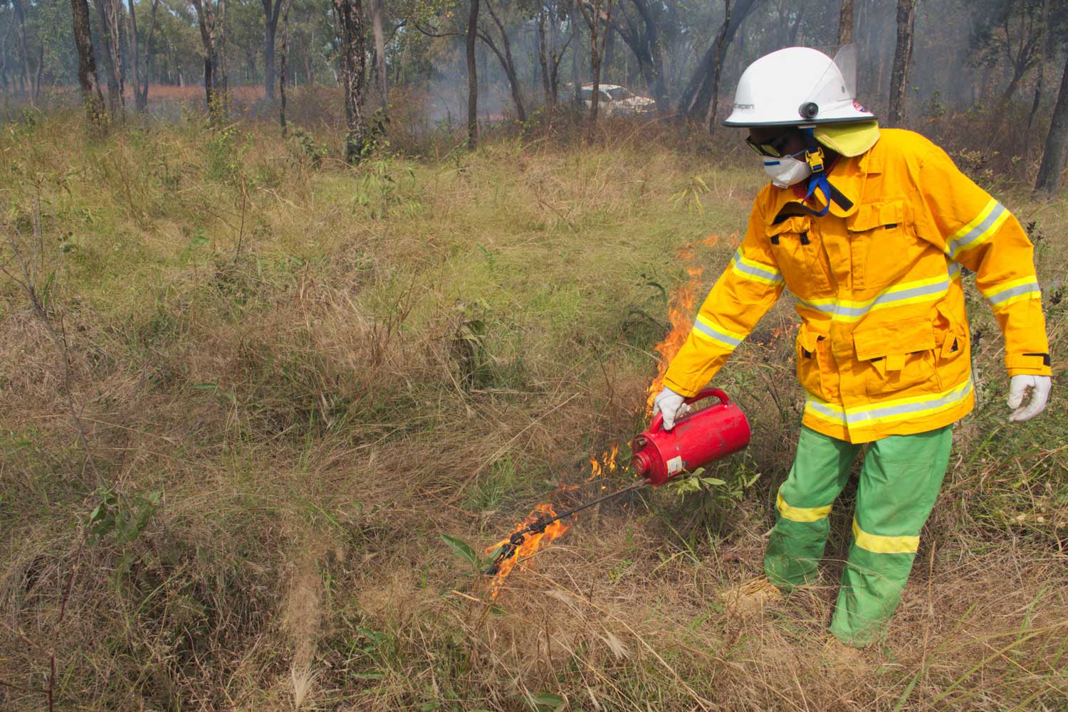
Skilled implementation of controlled burning using a driptorch
By the numbers
40,000 hectares
of improved vegetation resilience from wildfire
10 landholders
already confirmed to participate at project commencement
3 priority regions
southern, central and northern Cape York
More than 60%
of Cape York Peninsula held as Aboriginal Freehold, embedding Indigenous land management across the region
This project is funded by the Queensland Government’s Natural Resource Management Expansion Program
