Over the past three years, Queensland Government’s Natural Resources Recovery Program (NRRP) has funded projects that strengthen landscape resilience, encourage sustainable practices and improve how we monitor the state of our natural resources.
NRRP funding goes to regional NRM organisations and other not-for-profit groups, including catchment care associations and Landcare groups, helping them support the needs of their local communities.
These projects have already made a real difference. Since 2022, work under NRRP has improved the condition of native vegetation across 5,107 hectares and land condition across 438,480 hectares.
But how do we know condition has improved? And what tools are used to measure it?
Introducing SWIF
The State-wide Indicators Framework (SWIF) provides organisations delivering natural resource management projects in Queensland with consistent methods and tools for collecting project impact data. The first of its kind in Australia, SWIF includes smart systems for analysing this data and combining it to tell a compelling and credible whole-of-Queensland story.
SWIF was developed by NRM Regions Queensland’s Lee Blacklock and consultant Penny Scott, in collaboration with the Queensland Government.
Condition Assessment Tools
The SWIF toolkit includes a range of methods for monitoring ecological condition, known as Condition Assessment Tools (CATs).
One of these is the Vegetation Condition Assessment Tool (VegCAT), a rapid ecological monitoring method that tracks changes in native vegetation condition. The method involves establishing a monitoring plot and collecting data including ground cover, vegetation regeneration, weeds and the structure of trees and shrubs. Entering this information into the VegCAT app automatically generates a condition score.
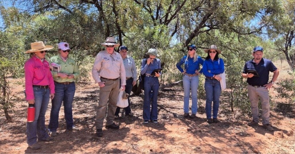
Regional NRM organisation Southern Gulf NRM has been supported by the Natural Resources Recovery Program to deliver LCAT training to build staff skills
Other methods in the SWIF toolkit include the Wetlands Condition Assessment Tool (WetCAT) and the Land Condition Assessment Tool (LCAT), both with companion apps. Both WetCAT and LCAT were developed by the Queensland Government with support from NRMRQ.
The data gathered through the apps is analysed using custom-built computer script and combined into a state-wide dataset that feeds an online SWIF dashboard. The detailed monitoring data sets remain with the organisations that collect them, supporting regional reporting as well as informing continuous improvement of projects.
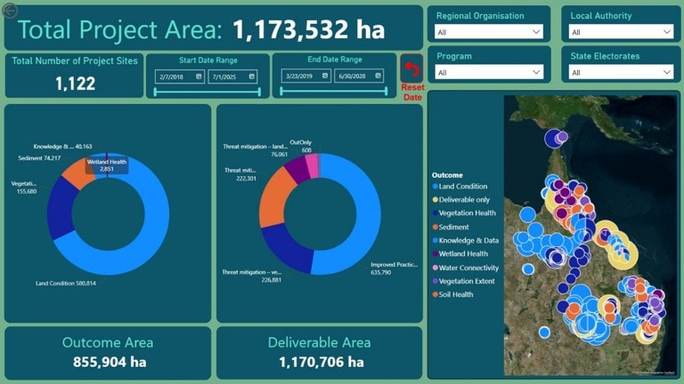
The SWIF online dashboard
Training for regional NRM organisations and delivery partners
To ensure accurate data collection across Queensland, the SWIF team regularly travels to regional areas to deliver face-to-face SWIF training.
Training sessions update users on recent developments and equip new staff with the skills needed to collect reliable data. In 2024–25, the team ran 12 regional events for more than 150 participants from 12 NRRP delivery partners. Many sessions included multiple groups, supporting knowledge sharing across regions.
Cape York NRM officers said the training helps to ensure consistent monitoring and evaluation, which is the backbone of state-wide storytelling.
“It was an informative session for the organisation to understand the importance of telling a story of the good work we do across our projects. It’s important not only for the public but also that our current and future funders understand the positive impact our projects are having,” said Biodiversity Program Manager David Preece.
Watch highlights from a Reef Catchments VegCAT training session here.
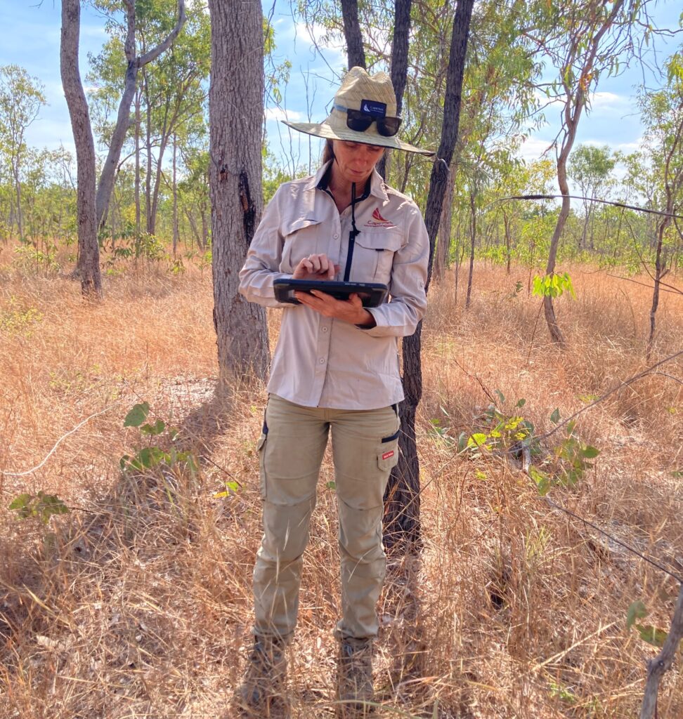
Regional NRM organisation Cape York NRM’s Maree Coulson inputting data in the field
Measuring more NRM project impact data
SWIF tools are also continually developed in response to emerging needs identified by practitioners and investors.
FireCAT, a method for assessing improved burning regimes, is expected to begin pilot testing with NRM groups in 2025–26. Development is also underway on a Riparian Condition Assessment Tool (RipCAT) to evaluate streambank restoration projects.
SWIF will also be used to quantify the impact of the Queensland Government’s $117.84 million NRM Expansion Program, delivered in partnership with NRM Regions Queensland. This in turn will see the development of Koala Habitat and Soil Health Condition Assessment Tools.
By using SWIF and these innovative methods, regional NRM organisations can continue improving Queensland’s landscapes and show the real impact of their work, as part of a state-wide story.
This story uses NRRP project impact data collected from July 2022 to December 2025.
This project is funded by the Queensland Government’s Natural Resources Recovery Program.
