Thanks to the Queensland Government’s $117.84 million Natural Resource Management Expansion Program, 35 projects are now being delivered across more than 468 on-ground project sites – from urban waterways in South East Queensland to remote wetlands, grazing properties and river systems across Cape York and the Gulf of Carpentaria.
But delivering practical, on-ground actions, across a state the size of Queensland comes with a challenge of scale and geography.
Many of these special places are challenging to access. Some cover enormous areas. Others contain species that are difficult to find or ecosystems where change needs to be monitored over years.
Increasingly, Queensland’s regional NRM organisations are using technology to extend their reach; putting more eyes and ears on the landscape, gathering better information and using new intel to guide practical action on the ground.
Reaching places people can’t easily go
At Kings Plains, around 50 kilometres southwest of Cooktown, Cape York NRM is tackling olive hymenachne, a Weed of National Significance that can form dense mats across waterways and displace native aquatic vegetation.
Drone herbicide spraying allows operators to accurately target infestations in difficult-to-access parts of the wetland system. By reducing the spread and density of invasive weeds, the work is helping restore native vegetation and habitat, improve wetland condition and protect water quality across the interconnected system. It forms part of a much larger program of invasive species management designed to improve the condition of 10,000 hectares of wetlands and 10,000 hectares of native vegetation across Cape York.
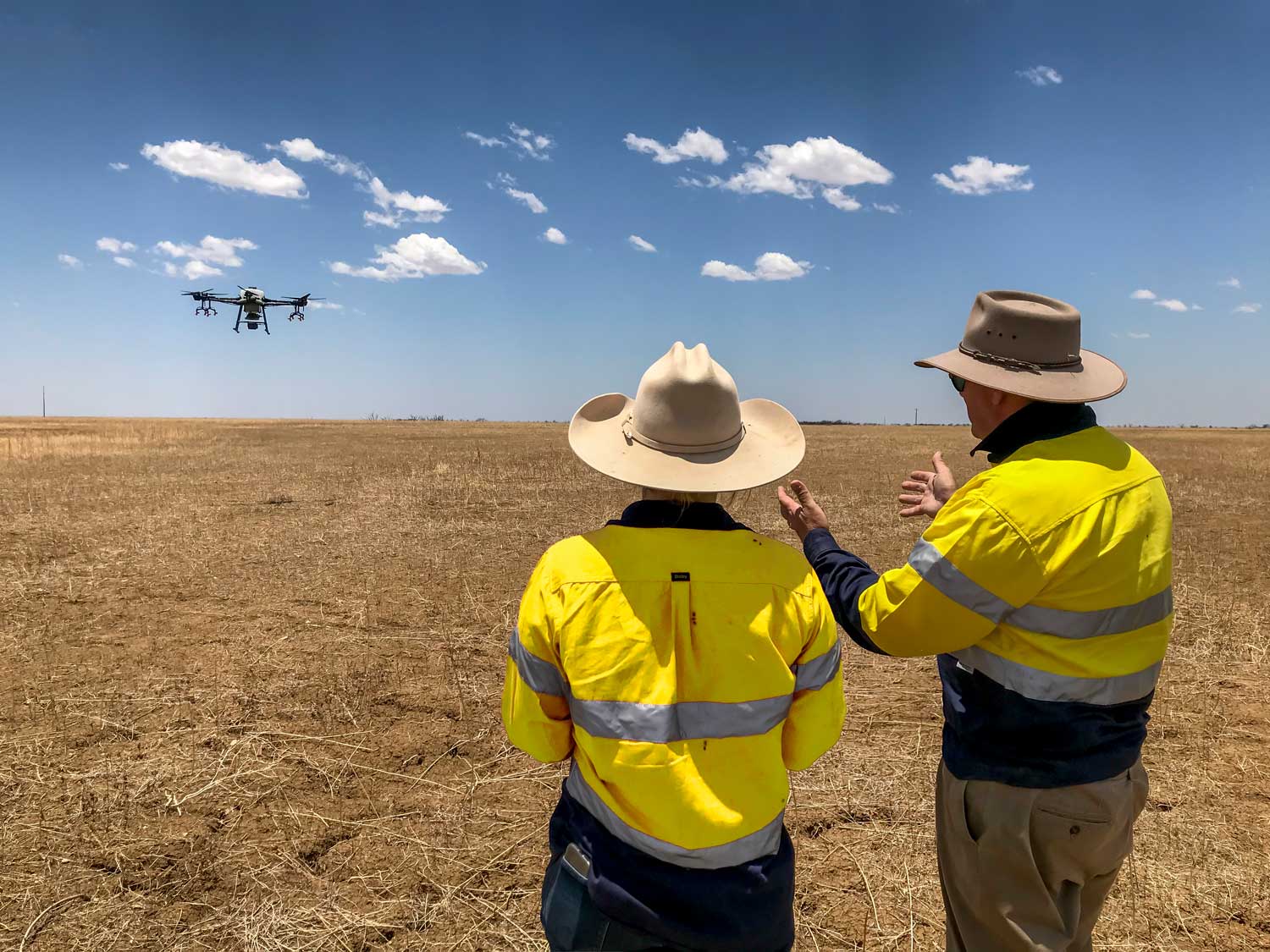
Elsewhere in North Queensland, drones are being used as monitoring tools.
Across the Northern Gulf of Carpentaria, Gulf Savannah NRM is using technology to help protect Great Artesian Basin springs – groundwater-fed wetlands that provide refuge for unique and potentially endemic plants and animals found nowhere else and are among Queensland’s most ecologically significant freshwater habitats.
More than 100 active springs are scattered across the region, but many have been affected by historical groundwater extraction and prolonged drought, leaving these fragile ecosystems particularly vulnerable to invasive plants and feral animals. Feral pigs are a major threat, digging and wallowing around spring edges in search of food, disturbing soil, destroying vegetation and degrading habitat for native plants and invertebrates.
On the ground, Gulf Savannah NRM is fencing springs to manage stock access and controlling feral pigs, with the project aiming to protect 12 hectares of spring habitat by improving water quality and supporting vegetation recovery. In the air, repeated drone surveys are helping the team measure whether those actions are working.
Hundreds of aerial photographs can be stitched together into a single high-resolution map, creating a detailed record of vegetation and soil disturbance that can be compared over time. Researchers are also developing a tool to analyse the imagery and automatically measure the proportion of soil disturbed by stock or pigs.
For project teams working across remote Northern Gulf landscapes, that means more than better pictures. Drone monitoring provides consistent evidence of how these ecosystems are responding to practical management, while reducing the need for people to repeatedly access difficult terrain – particularly during floods and periods when properties can be isolated.
Finding what can’t easily be seen or heard
Technology is also helping regional NRM organisations establish what species are present before – and after – on-ground management actions.
Environmental DNA, or eDNA, can detect genetic material organisms leave behind in water or soil.
Gulf Savannah NRM is combining eDNA with camera traps and acoustic recorders to build a more complete inventory of species using its Great Artesian Basin spring sites.
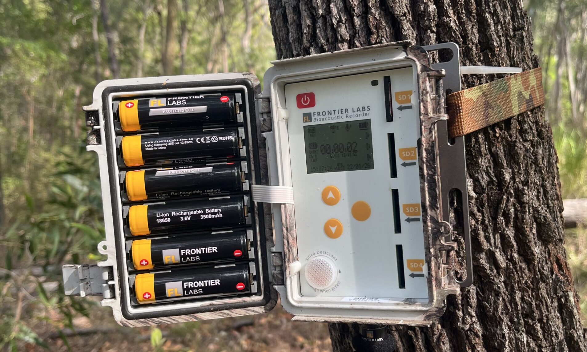
Acoustic recorders capture the sounds of wildlife, which researchers analyse to identify the species present. Photo: Guy Castley.
NQ Dry Tropics is similarly using camera traps, acoustic recorders, eDNA and fauna surveys to establish biodiversity baselines across wetlands and threatened coastal vegetation in the Lower Burdekin. The monitoring will help track how species and ecosystems respond as the Climate-Ready Coastlines project restores wetlands, reconnects waterways for fish passage, controls invasive species and improves threatened beach scrub.
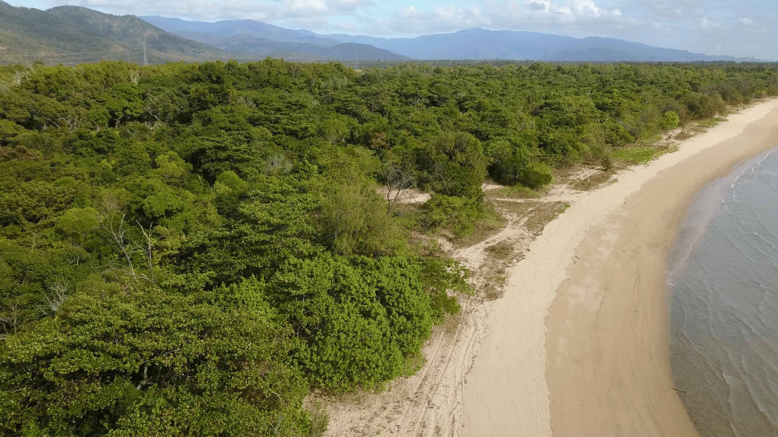
Beach Scrub – a Threatened Ecological Community in the NQ Dry Tropics region.
In the Southern Gulf, eDNA, remote sensing and water-quality monitoring will help measure how wetlands respond as Southern Gulf NRM works with landholders across ten properties to reduce feral pig impacts. The pigs damage wetlands through wallowing and trampling, contributing to erosion, poorer water quality and habitat loss – so the technology will help determine whether practical pest control is translating into healthier wetlands and waterways.
Technology is also helping protect one of the Gulf’s rarest reptiles. Southern Gulf NRM is using eDNA to detect Gulf Snapping Turtles and invasive tilapia, while underwater cameras are providing another window into aquatic life. Remote cameras are also tracking feral pigs around potential nesting sites, building the evidence needed to target control of a major predator of turtle eggs and hatchlings.
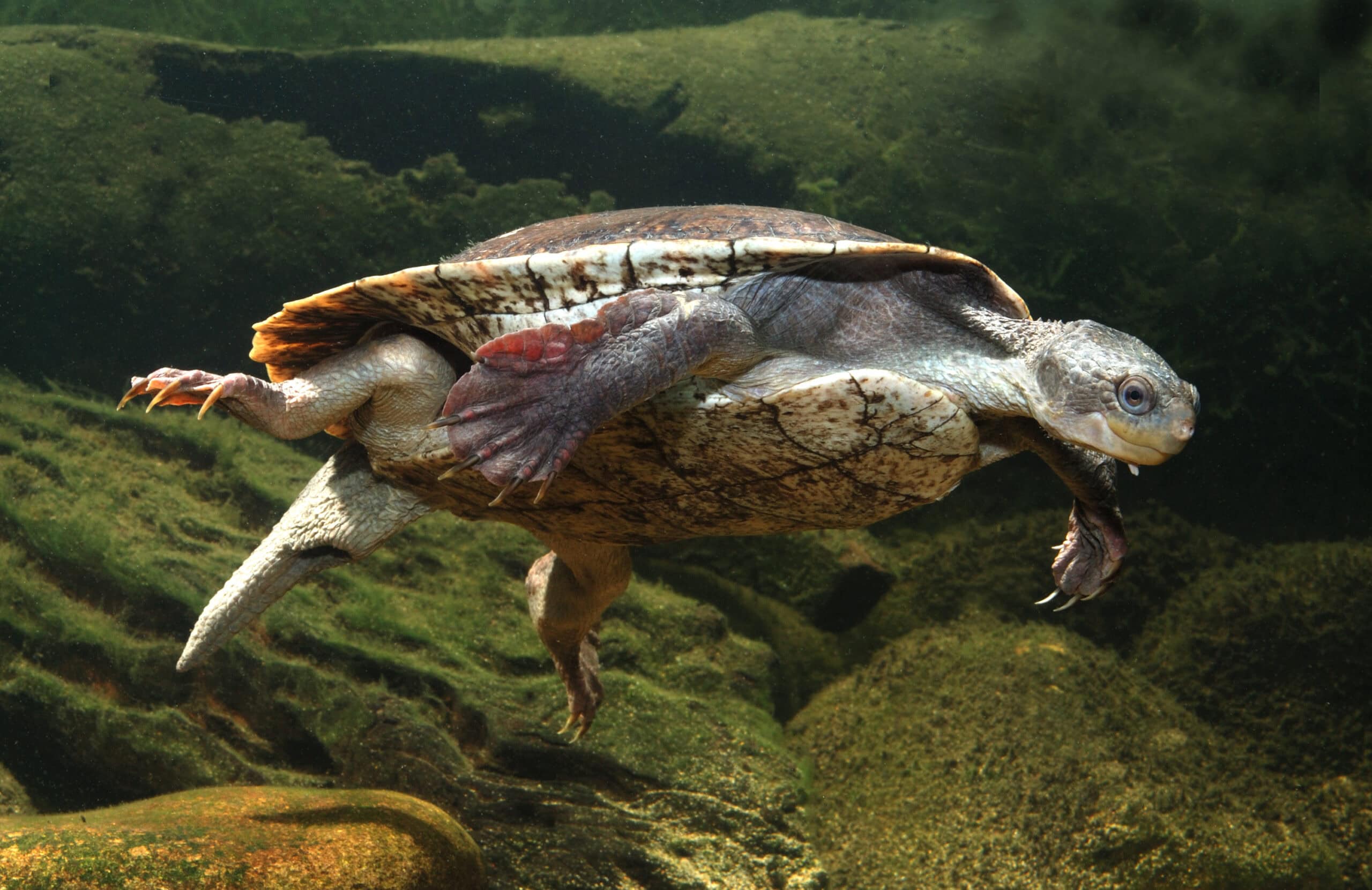
The Gulf Snapping Turtle was once thought extinct. Photo: Lochman Transparencies
Better information before the machinery arrives
Technology can never replace practical on-ground NRM or the expertise of the people who know these landscapes. But increasingly, it is helping make that work safer, better targeted and more effective.
At Cattle Creek in the Pioneer Valley, Reef Catchments is restoring five priority streambank sites across two kilometres of creek, reducing erosion, protecting productive agricultural land and reducing sediment entering the Pioneer River and Great Barrier Reef lagoon.
Before designs could be developed, detailed site surveys, ecological assessments and LiDAR mapping were undertaken. A LiDAR-equipped drone captured detailed site data, allowing engineers to design restoration works around the conditions at each location. When flooding associated with ex-Tropical Cyclone Koji caused banks at some sites to retreat by up to eight metres, engineers were able to revisit those designs before construction proceeded.
That detailed planning is now translating into physical action, with approximately 10,000 locally sourced native plants being propagated and more than 12,700 tonnes of armour rock being sourced to stabilise actively eroding streambanks.
In Southern Queensland, technology is being applied directly to grazing management, with Southern Queensland Landscapes supporting a landholder to develop a virtual fencing system. Virtual fencing uses GPS-enabled collars and digital boundaries to influence where cattle move, without the need for a physical fence. This gives landholders another practical tool to manage grazing pressure, keep cattle away from sensitive waterways and protect riparian areas.
And in South East Queensland, Healthy Land & Water’s Urban Rewilding project is taking monitoring into the treetops. Forty Comfy Creatures nest boxes being installed across the Redlands, Noosa and Gold Coast will include self-contained, solar-powered monitoring stations that stream live footage to a smartphone while recording environmental conditions including temperature, humidity, pressure and light.
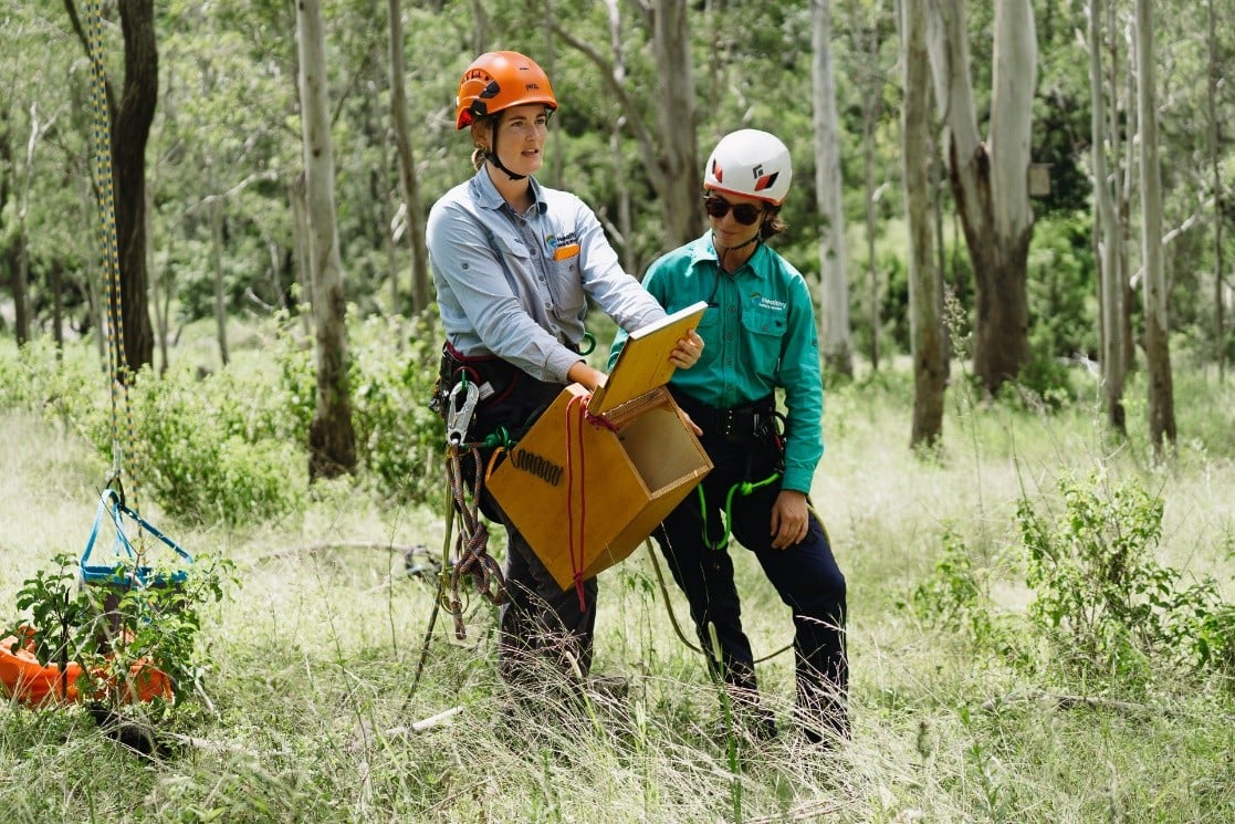
HLW staff preparing to install nesting boxes for threatened species.
The technology turns habitat refuges into ongoing monitoring stations – providing a window into how wildlife uses the habitat being created and helping build knowledge to guide future conservation efforts.
Technology with a practical purpose
Across 468 project locations, there will never be enough people to physically watch every wetland, waterway, nesting site or patch of vegetation.
And technology cannot replace the knowledge of landholders, Traditional Owners, rangers, scientists and regional NRM practitioners who understand these landscapes.
But it can extend our reach, and used strategically, these tools mean better evidence, safer monitoring and more targeted investment – helping regional NRM organisations make the most of public funding across a vast and geographically challenging state.
And ultimately, their value is measured not by the technology itself, but by what happens as a result: the control of weeds, management of feral animals, restoration of waterways, improved soil condition, protection of habitat and better management decisions made in the office and on the ground.
The Queensland Government’s NRM Expansion Program is a collaboration with NRM Regions Queensland.